High peaks: 8+ hours
Big, bold, and beautiful, the Adirondack High Peaks have been a magnet for explorers for more than 150 years. The original list of High Peaks included the 46 Adirondack mountains that were higher than 4,000 feet in elevation. Later, it was determined that one mountain had been overlooked and four of the original group were actually a little lower than 4,000 feet.
These days, people seeking the coveted 46er patch must summit the mountains on the original list. All but four of the High Peaks are located in the Lake Placid/Keene-Keene Valley area. The other four, Seymour Mountain and the Seward Range, are located a bit to the west.
Roughly twenty of the High Peaks do not have a marked trail to the top. On those mountains unmaintained, unmarked herd paths have developed over the years. These paths are generally easy to follow, but anyone attempting them should know how to use a map and compass. Hikers are urged to buy a good hiking guidebook or to hire an Adirondack guide.
Learn more about the High Peaks and read on to see some of our top picks
Panther Peak - - 18th Highest Peak
This is an approximate 6.25 mile hike, one way. From the parking area this route follows a gravel road (access to a private hunting camp) for 1.8 miles to a sharp and somewhat obscure right to a foot trail. The first bridge is out and you will need to ford the branch of Santanoni Brook. The second bridge is in poor shape but can still be crossed. Be very careful as it is slippery and quite high off the ground. The handrail is missing and the stairs on the opposite side up the steep embankment are slightly angled and equally as slippery. This trail has been notorious for being the wettest trail in the Adirondacks and for good reason. However, work is in progress to remedy this. Several small re-routed sections have been developed, wet areas closed off, and stringers have been laid out for easier passage. There is still much work to be done, but this is a wonderful start.
At 3.4 miles there are some beautiful cascades on the left. 200 yards beyond there is a cairn marking the start of the direct trail to Santanoni. At 4.3 miles, another cairn marks the start of the herd path to Panther. The herd path stays flat until you pass Bradley Pond, then it climbs very steeply above the pond before starting a more slightly more moderate grade. You will drop slightly to Panther Brook and follow its course to the top of the ridge. At the first junction of paths (Herald Square) the trail to Panther goes right for 0.4 miles to Panther’s summit. Left leads to Santanoni and Couchy and Times Square where a path leads straight to Couchsachraga and left to Santanoni.
Directions: 60.6 miles | 1hr 17 minute drive
Turn left out of the Golden Arrow. Turn right at the second light (Sentinel Road.) Continue on 73E to Keene Valley. Merge onto 9S. Turn right to merge onto I-87s and get off Exit 29 (Newcomb.) turn left onto Blue Ridge Road. Continue for roughly 18 miles to the Tahawus Road (CR25) on the right. Follow this road to a sharp left at a sign for Mt. Marcy and the High Peaks Trails. Two miles from this junction there is a parking area on the left, which is the approach to the Santanoni Range.
Note: Panther Peak is part of the Santanoni Range. Do not confuse with Panther Mountain, which is a 0.9 mile moderately trafficked out and back trail located near Tupper Lake, New York.
Sawteeth - - 35th Highest Peak
Kenne Valley, NY
~12 hours
Elevation: 4,100ft
Roundtrip: 13.1 miles
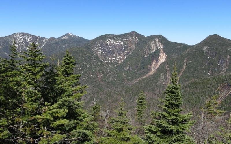
Sawteeth has two very different views depending on which side of the summit you happen to be on. On the southeast or lake side of the peak there are excellent views of the Ausable Lakes and Colvin Range that persist from early in the ascent all the way up. Once over the top you are presented with views of the Great Range less than a half mile to the north. These are outstanding, bordering on fantastic views that take in much of the Great Range with dramatic close-ups of the slides and the rock faces of Basin, Pyramid, and Gothics. Hikers or climbers approaching any of the peaks that branch off the Lake Road should be aware of the parking restrictions in the area.
Sitting near the Great Range, the peak offers a great view of almost every peak in that range. The normal route is to come from the east through the Adirondack Mountain Reserve down the Lake Road and then up from Ausable Lake. A good moderate hike for the day as the climbing is short and the walk in and out is easy but long (over 6 miles one way). A good high peak for kids and older people if the Scenic Trail is taken in and the New Trail out. This hike begins as an easy four mile hike along the Ausable Club’s “Lake Road” across AMR land from the DEC parking lot on NY 73 near the Ausable Club to the start of the Scenic Trail near the Boathouse. The ascent of Sawteeth via Scenic Trail is difficult and strenuous. It is steep to very steep. Trail condition is excellent. The descent is moderate via the Alfred E. Weld trail. Here the trail is excellent and not particularly steep. Return to the Ausable Club via the easy to moderate East River Trail.
Directions: 22.7 miles | 34 minute drive
Turn left out of the Golden Arrow. Turn right at the second light (Sentinel Road.) Continue on 73E towards Keene. The designated hikers’ parking lot is just off 73, opposite the parking lot for the Roaring Brook Trail. (This spot is three miles south of the High Peaks sign in Keene.) From here it is about a 0.5 mile hike along the gravel road and past the golf course to the start of the Lake Road and the trailhead.
Mount Haystack - - 3rd Highest Peak
Keene Valley, NY
~12 Hours
Elevation: 4,960ft
Roundtrip: 16.5 miles
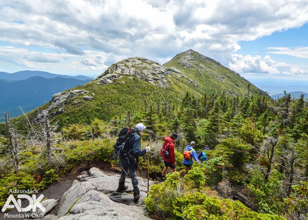
Haystack is one of the most demanding hikes of the 46 High Peaks due to its rugged terrain and hiking distance. The summit of Haystack is a bald dome in the shape of a stack of hay. Its appearance is not like the other High Peaks in the Adirondacks. For the main approach it requires the climber to hike over Little Haystack as well, which may not seem like much, but adds even more elevation change for the day. Heavy winds often buffet this peak, but if you have it in you, it’s worth every step.
Do not confuse this high peak with Haystack Mountain, a 3.3 mile (one way) trail in Ray Brook, NY.
Primary Trailhead: This is an 8.8 mile hike, one way with a mixture of demanding terrain. From the Garden Parking Area, the terrain is gently rolling hills till you drop steeply into Johns Brook Valley at 3.0 miles. Making a right into the valley you will continue a bit further to Johns Brook Lodge. Continue straight past Johns Brook Lodge and head toward Bushnell Falls. Avoiding the side trail leading to the base of the falls, continue to the junction and go left and down and now with red markers to cross Johns Brook. As you pass by the Bushnell Falls lean-to the grade will be moderate but a continuous climb to Slant Rock. From Slant rock you will climb steep and steady to the intersection with the Marcy Trail. Continue left and climb very steeply to an amazing view of the Haystacks. From here it is a slight descent to the base of the tree line. From here you will be totally exposed to the elements all the way to the summit. First you climb Little Haystack and then descend to a col before an open rock climb to the summit of Haystack.
Directions: 21 miles | 30 minutes
Turn left out of the Golden Arrow. Turn right at the second light (Sentinel Road.) Continue on 73E to Keene Valley. Turn right after the Keene Valley Ausable Inn (Adirondack Street) and continue for 1.6 miles, the last 0.2 mile on a narrow dirt road
Second Trailhead: This is a 16.5 mile round trip with a moderate climb. Starting from the Loj parking you will pass by Marcy Dam where excellent views of the High Peaks can be had. The trail then follows along Phelps Brook before it enters its steepest portion up to Indian Falls. From Indian Falls you will enjoy a very moderate ascent up to the trail intersection with Haystack at 4,900 feet. From here you will have to descend quite a bit to 4,200 feet to reach the primary trail mentioned above
Directions: 8.5 miles | 19 minute drive
Turn left out of the Golden Arrow. Turn right at the second light (Sentinel Road.) Continue on 73E towards Keene. Take the first right after the ski jumps onto Adirondack Loj Road. Follow to the end at the hiker parking area, where there is a fee to use the lot.
The only thing we overlook is the lake
Surrender yourself to the natural and untouched beauty of the Adirondack Mountains at the first resort in the U.S. to receive the Audubon International’s Platinum Eco Rating for Hotels. There are now only six hotels in the United States to obtain this honor! It’s a place to renew yourself on the serene shores of Mirror Lake, and take in the history of the town, just steps away from the famed Olympic Village and the heart of Lake Placid, New York. No other place on earth provides this unique blend of comfort, rejuvenation, or one-of-a-kind experiences. Start planning your stay at the Golden Arrow Lakeside Resort now!


