Become a Lake Placid 9er
The Lake Placid 9’er is an Adirondack hiking challenge recently created in 2018 and is based in the Lake Placid, NY region. The 9er offers a unique opportunity to explore some of the Lake Placid region’s more approachable peaks, all of which can be conquered in a morning or afternoon.
The peaks were selected to offer some of Lake Placid’s most breathtaking views, without having to hike the 4000+ ft climb of the popular 46 Adirondack high peaks in the area. The 9’er offers a true Lake Placid experience, including views of the popular Whiteface Mountain, a chance to scale an ADK fire tower, and a trip to the historic Adirondack Loj.
Are you ready to take on the challenge?
How to Tackle the LP 9’er
We recommend hiking the peaks in the order that they are listed, by level of difficulty. The peaks have been chosen in a way that hiking them in order will prepare your body (and lungs) for the hike ahead. The challenge can be accomplished in the standard form, as an ULTRA 24-hour challenge, or as a Winter challenge.
Find out more about becoming an LP p’er!
I’ve personally hiked the peaks with an * next to them and highly recommend checking them out!
Lake Placid, NY
Elevation: 2,332 feet
Roundtrip: 2.2 miles
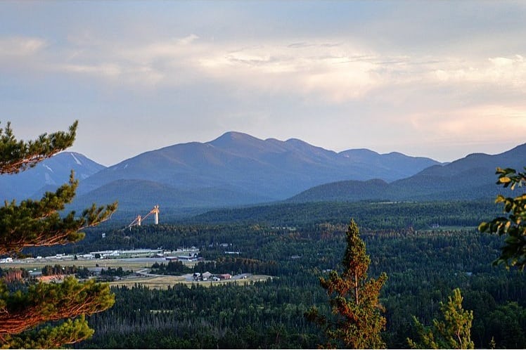
About: A great hike for the whole family with a fun view of Lake Placid. Perfect to start on or add to an afternoon in Lake Placid with the trailhead starting near Main Street, Lake Placid. Because it’s so close to town, this is a great hike to take at sunset!
Trailhead: Turn left out of the driveway. Continue straight past the church on to Parkside Drive. Turn left at the four-way stop and follow Mirror Lake Drive past Northwood Road to the entrance to Northwood School. There is a trailhead parking area 200 yards up this entrance road on the left. One can also park on Main Street, enjoy a stroll around Mirror Lake, and pick up the trailhead on foot with ease.
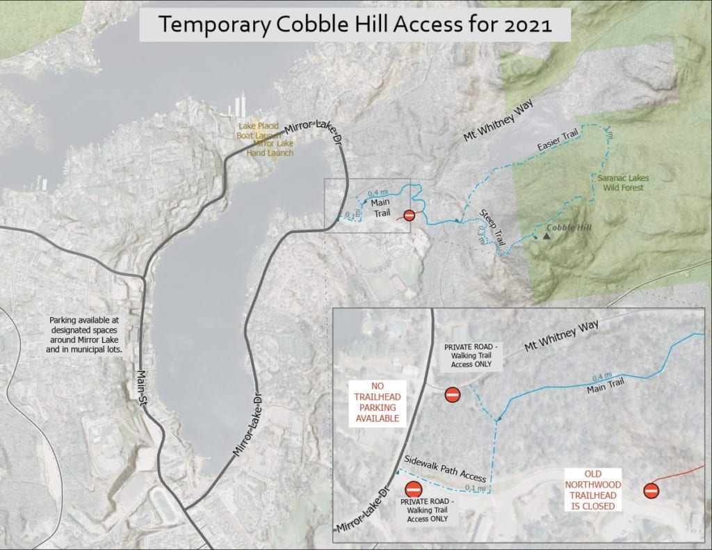
2021 Update: There is no longer any trailhead parking for Cobble Hill trails, so Lake Placid–area hikers are encouraged to base Cobble hikes from your home or hotel, or to begin your walk from a designated parking space on Mirror Lake Drive or a municipal lot.
Temporary foot access will be provided for 2021 over private lands from a trailhead near Northwood School’s Mirror Lake Drive gate, and from a trailhead on Whitney Road, just steps from Mirror Lake Drive. There is no parking at either trailhead, so hikers should factor approximately a half-mile walk from the downtown Lake Placid area.
Lake Placid, NY
Distance: 2.6 miles round-trip
Elevation: 2,876 feet
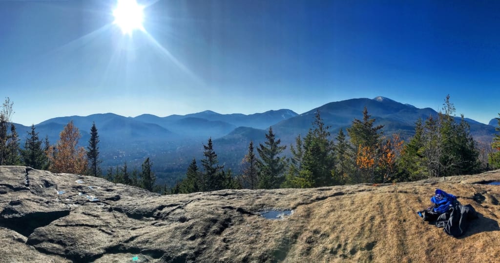
About: One of the most popular hikes in Lake Placid for good reason. Major high peak views for a minimal effort. This mountain offers two trails up/down or can be hiked as a loop trail, which we recommend. The longer trail is a more gradual climb and better for new hikers while the shorter trail is a much steeper climb. The two trails rejoin prior to the summit.
Trailhead: Turn left out the parking lot. Follow Main Street to the second stop light. Turn right on to Sentinel Road/73E. Follow Rt. 73 to Adirondac Loj Road, which is the first right after the ski jumps. Follow Adirondac Loj Road for about 5 miles. There is a $10/day parking fee.
Keene, NY
Distance: 2.4 miles round-trip
Elevation: 2,440 feet
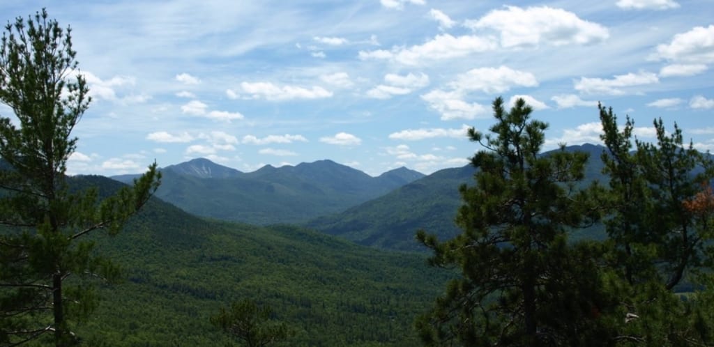
About: Another excellent hike for the whole family. Easy to moderate terrain and switchbacks make this trail an excellent peak early in the challenge to prepare your lungs for the hikes to come. The trail is on private land and graciously opened to the public by its owners so give extra special care to leaving no trace on this peak.
Trailhead: Turn left out the parking lot. Follow Main Street to the second stop light. Turn right on to Sentinel Road/73E. Follow 73E toward Keene. Continue through Keene and turn left on Route 9N S toward Elizabethtown. Continue for about 2 miles to the top of the hill and park at the trailhead on the right — look for the DEC sign. If you come to Baxter Mountain Tavern you have gone a bit too far.
Lake Placid, NY
Distance: 4.4 miles round-trip
Elevation: 2,940 feet
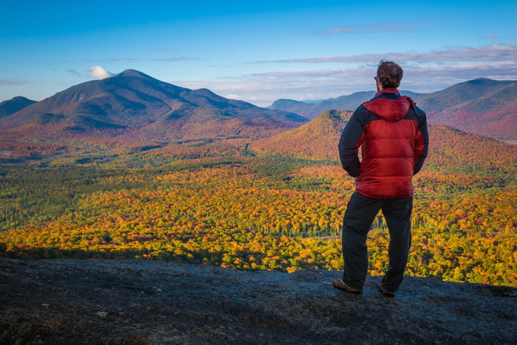
About: A great hike and typically not as busy as many of its counterparts. This mountain is home to the Olympic bobsled and luge run but also offers excellent hiking. The trail begins with a long flat walk into the woods to warm up the legs. Soon you’ll come to a pond which you will follow around to the left. It can be slightly tricky to navigate but just follow the trail markers and trail around the pond to the ascent. This part can be wet/muddy so be prepared and calculate every step. Once around the pond the trail begins to climb. Moderate terrain makes up most of this hike and after coming to the first rocky ledge clearing, the true peak is slightly further up the trail. This summit offers unique views that cannot be matched.
Trailhead: Turn left out the parking lot. Follow Main Street to the second stop light. Turn right on to Sentinel Road/73E. Follow Rt. 73 to Adirondac Loj Road, which is the first right after the ski jumps. Follow Adirondac Loj Road for about miles. Trailhead will be on the left, across from Mt. Jo trail. There is a $10/day parking fee.
Keene, NY
Distance: 1.4 miles round-trip
Elevation: 2,815 feet
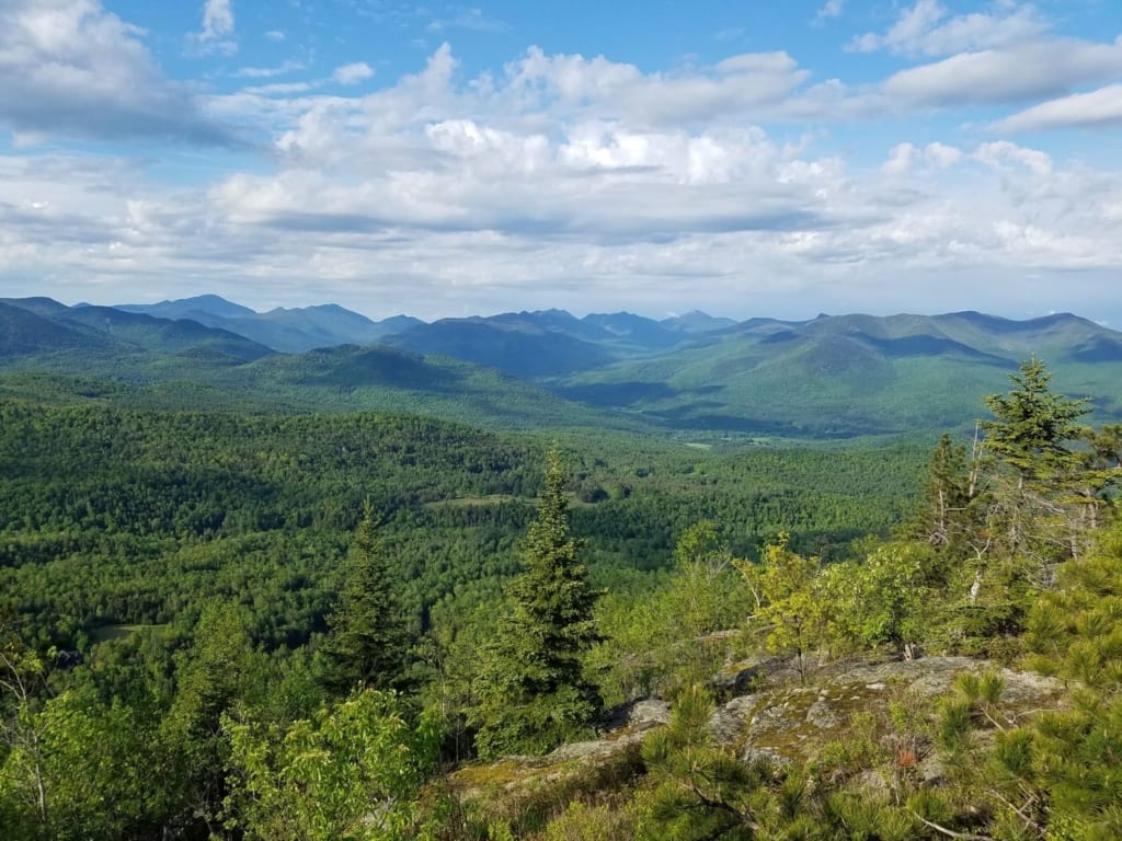
About: A quick hike but don’t let the mileage fool you. After a short hike into the woods this trail goes straight up all the way to the top, your lungs (and legs) will be working hard for this one. Excellent views of Hurricane and the surrounding range.
BONUS PEAK- Upon summiting Big Crow you will see Little Crow down to the right which can be hiked in one trip. Follow the cairns (stacked rocks acting as trail markers) along the peak and the trail markers and you’ll head over to Little Crow and bag “The Crows” in one day. If doing this we recommend making it a through hike and going down Little Crow which will take you to Hurricane Road. At this point you’ll walk a mile back to your car and the loop will be complete. Once you come out of the woods to the street go left on Hurricane Road, then left on the dirt road O’Toole Lane to the end, Crows Clearing, where you parked for Big Crow.
Trailhead: Turn left out the parking lot. Follow Main Street to the second stop light. Turn right on to Sentinel Road/73E. Follow 73E to Keene. 200 yards past the intersection with Route 9N in Keene, turn left on to Hurricane Road (by Keene Town Hall.) Follow Hurricane Road to O’Toole Lane (dirt) for 1.2 miles to the end at Crow Clearing. The trail to Big Crow begins on the left side of the clearing. (In winter, the end of plowing is 0.3 mile before Crow Clearing, and this final stretch is usually closed during muddy spring season as well).
Wilmington, NY
Distance: 4.5 miles round-trip
Elevation: 2,650 feet
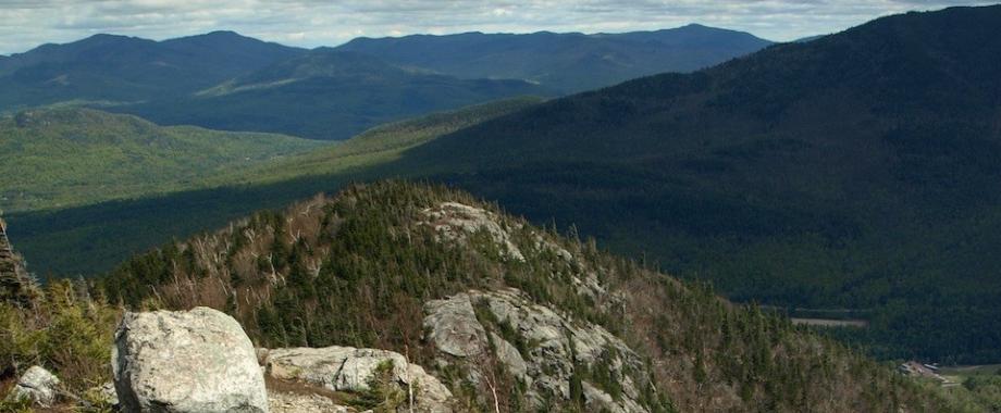
About: A hidden gem in the Adirondacks offering unique views of the popular Whiteface Mountain and its region. The bottom portion of the trail is also a mountain bike trail to be mindful of riders if you pass them. This hike enjoys switchbacks throughout and will certainly test your aerobic conditioning as it continuously goes up without many breaks. Great summit views of Whiteface.
BONUS PEAK- Just before the final hike to the summit the trail splits, with Bear Den to the left and Flume Knob to the right. If you’re up for one other quick peak after Bear Den we recommend summiting Flume Knob and bagging two peaks in one day. This mountain offers similar views while also seeing Bear Den in the foreground. The hike from the trail split to the summit is roughly 15-20 minutes up.
Trailhead: Turn left out of the hotel. Stay on route 86 towards Wilmington. Continue for 9.2 miles to the Whiteface Mountain Ski Center. Turn left into the center and follow the road around to the right and to the Bear Den Lot.
Lake Placid, NY
Distance: 5.2 miles round-trip
Elevation: 3,500 feet
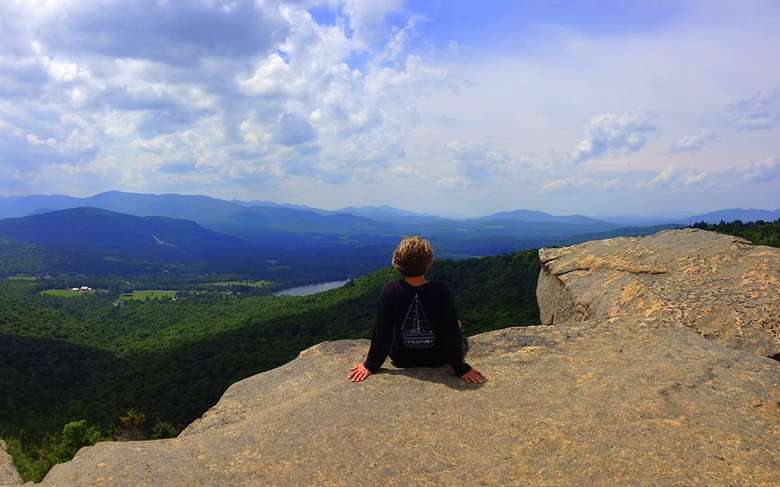
About: A fan favorite in Lake Placid and a well traveled trail. Can be done as a through hike (we recommend two cars if doing this, one at Pitchoff East parking and one at Cascade/Pitchoff parking. Or to minimize parking issues entirely, get dropped off/picked up) or out and back from either trailhead, though we recommend the Cascade/Pitchoff parking trailhead. The trail enjoys lookouts throughout the hike, perfect for water breaks during the ascent. Some steep climbs and can be a muddy trail if the conditions aren’t great. The peak is wooded with some views but we recommend after summiting to go back down and take the very short hike over to Balanced Rocks (look for a trail split and markers pointing you to Balanced Rocks) and spend some time there, you won’t regret it. Remember to follow the cairns when you get to the rocky summits.
Trailhead: Turn left out the parking lot. Follow Main Street to the second stop light. Turn right on to Sentinel Road/73E. Continue on Route 73 for 7.5 miles to the Pitchoff West Trail. For Pitchoff East Trail, continue 2.7 miles further on Route 73. Both trailheads are on the left, but parking is along the right shoulder. Be careful when crossing this busy road.
Wilmington, NY
Distance: 3.6 miles round-trip
Elevation: 3,169 feet
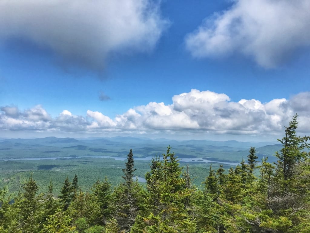
About: Arguably the most challenging peak of the 9’er roster due to it’s steep climbs, and need to pay close attention to stay on trail. This peak has it all from rock climbs, scrambling, chimneys, false summits, and astounding views. Be sure to pay close attention to the cairns (rocks stacked on top of each other) and trail markers as it’s easy to get off trail but knowing this ahead of time is half the battle and will help tremendously. A true hidden gem in the Adirondacks.
Trailhead: Turn left out of the hotel. Follow route 86 to Wilmington. At the four-corner intersection in the village of Wilmington, turn left on to Route 431. At the intersection with the Whiteface Memorial Highway, just before the toll house, bear right on Gillespie Drive. Continue for 3.2 miles to Roseman Road and take a right. Follow Roseman Road for 0.8 miles and turn right on Plank Road. Follow that for about 2 miles to the parking area on the left.
Keene, NY
Distance: 6.8 miles round-trip
Elevation: 3,678 feet
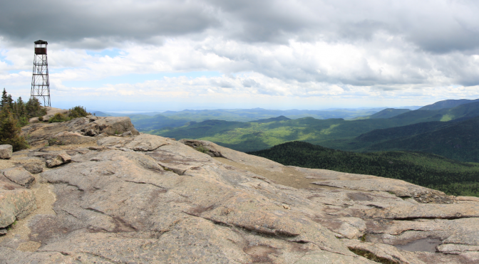
About: One of the best hikes in the Adirondacks, period. A new trail was recently cut and offers many different terrains throughout ending with a beautiful 360-degree rocky summit and an Adirondack fire tower to top it off. Very well marked, one of the harder hikes of the 9’er challenge, but well worth the effort and an epic finish to the challenge if you hike this last. Can be hiked from the trailhead above or from Crows Clearing trailhead, we recommend the trailhead above but both are viable options.
Trailhead: Turn left out the parking lot. Follow Main Street to the second stop light. Turn right on to Sentinel Road/73E. Follow 73E for about to Keene. Turn left onto Route 9N S. Turn left on to Hurricane Mountain Lane. The parking area will be on the right.

-Joell
Marketing Director
The only thing we overlook is the lake
Surrender yourself to the natural and untouched beauty of the Adirondack Mountains at the first resort in the U.S. to receive the Audubon International’s Platinum Eco Rating for Hotels. There are now only six hotels in the United States to obtain this honor! It’s a place to renew yourself on the serene shores of Mirror Lake, and take in the history of the town, just steps away from the famed Olympic Village and the heart of Lake Placid, New York. No other place on earth provides this unique blend of comfort, rejuvenation, or one-of-a-kind experiences. Start planning your stay at the Golden Arrow Lakeside Resort now!
